BEENLEIGH AIRFIELD
USED BY THE MILITARY AS
AN EMERGENCY LANDING GROUND (ELG)
DURING WW2
![]()
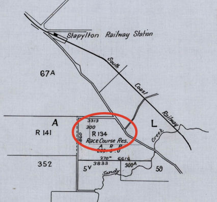
Plan in National Archives showing
site of a proposed
Beenleigh Airfield. Was it ever built in that location?
Beenleigh Airfield was used by the military as an Emergency Landing Ground (ELG) during WW2. It was located at 27.42 Lat and 153.15 Long. The airfield was under civilian control during WW2. It was located on Herbst Paddock which was a dairy farm owned by two brothers .
It was a Type A-1 airfield which meant there was one runway greater than 1,200 yards long.
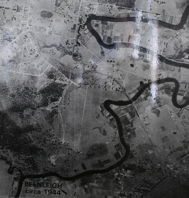
I spotted this photo on the wall
of the premises of the Logan River & District
Family History Society Inc. in the Beenleigh Historical Village and noticed the
cleared area in the centre of the photo to the left of the Albert River. This
was the
former Beenleigh airfield. This area is now
known as Mount Warren Park.
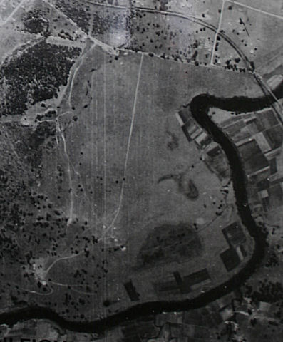
A close-up of the above 1944
photograph showing the former
Beenleigh Airfield. The length of this area is about 1,300 metres.
Can anyone help me with more information?
"Australia @ War" WWII Research Products

|
|
© Peter Dunn 2015 |
Please
e-mail me |

This page first produced 8 April 2006
This page last updated 13 January 2020